



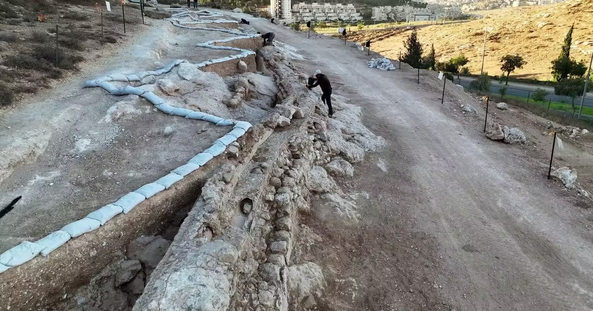

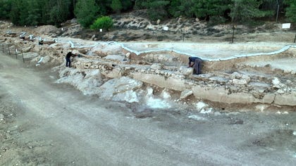
A 300-meter stretch of the Lower Aqueduct into Jerusalem has been revealed exactly where archaeologists thought it would be – about 5 kilometers south of Temple Mount, near Kibbutz Ramat Rachel. It was unearthed during works to build a new neighborhood, the Israel Antiquities Authority announced on Sunday.
Knowledge of the aqueduct was actually never lost since the structure remained in use for over 2,000 years, apparently since the Hasmonean period in the late second century to first century B.C.E. In fact it only fell out of favor about a century ago, when newfangled inventions such as electricity enabled better alternatives. But it was covered over by the debris and detritus of time; and archaeologists assessed where it was based on surveys starting in the 1970s, explains Benyamin Storchan, co-director of the IAA excavation together with Gil Freid and Rotem Cohen.
In addition, there aren’t many options to route a constantly declining water conduit from the Gush Etzion settlement bloc about 12 km southwest, where this structure begins, to the Old City of Jerusalem. Hence even though this section of the aqueduct hadn’t been located before – the archaeologists had an idea where it had to be, and it was.
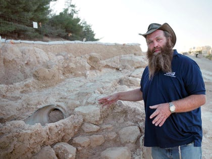
Note that pieces of this aqueduct can be seen here and there along its route, all but hidden in the modern development. This time the plans for the new neighborhood take this ancient element into consideration and will work around and showcase it, Storchan says.
The winding road deterrent
We cannot be sure the aqueduct was used without cease from the Hasmonean, Herodian and/or Roman periods until the British Mandate. It is possible that usage stopped here and there, but there is clear historic evidence of use in the Byzantine and later periods. One example is an inscription in Arabic from the Mamluk period associated with its reconstruction. Moreover, come their time, the Ottomans would line the aqueduct with ceramic pipes.
The British, says Storchan, even thought of reinvigorating the conduit in their time using long metal pipelines but gave up, because in order to maintain its decline from the point of origin, the aqueduct winds around hills, which short ceramic tiles can do but long straight pipelines can’t.
In the day, actually, there were two ancient aqueducts into Jerusalem, the Upper and Lower, and neither has been securely dated. It appears however that this Lower one was built first, Storchan says, based on the assessment that the upper one seems more structurally sophisticated. It also seems to follow a straighter path, he adds.
That said, the “unsophisticated” Lower Aqueduct seems to have lasted longer than the fancier Upper onehe adds.
The starting point for Jerusalem’s water system was natural springs in Gush Etzion. Each feeds into a small water channel that in turn feeds into the so-called Solomon’s Pools in Bethlehem, which is just a large manmade reservoir. Thus the two aqueducts begin at Solomon’s Pools.
The pools are traditionally linked to King Solomon some 3,000 years ago based on the verse: “I made myself pools from which to water the forest of growing trees” – Ecclesiastes 2:6 – but it’s a misnomer, Storchan says. This reservoir had nothing to do with the fabled kingbut is instead apparently from the Hasmonean era, which lasted from 142 to 37 B.C.E.
So, from somebody’s pools, the Lower Aqueduct runs through Bethlehem, looping around the Jerusalem hills and to the Armon Hanatziv neighborhood, passing beneath what is today the Abu Tor promenade where the ancients carved a tunnel through the mountain. A fine one, with shafts for ventilation and to remove quarrying debris. The path then proceeds looping around Hutzot Hayotzer, traverses the Guy Ben Hinnom valley, goes around Mount Zion and into the Old City, somewhere around the Dung Gate, to the Temple Mount.
One understands why the British decided to give up rebuilding this path using modern pipes.
This newly unveiled 300-meter stretch is the biggest found to date of this monumental structure, which runs 26 kilometers as it winds around the hills, the archaeologists say.
All in all, from its start, the aqueduct declines all of 40 to 30 meters in height, which was a tremendous feat of ancient planning, Storchan marvels. No later and more technically advanced civilizations changed a meter of the route, not the Byzantines nor the later Umayyads – it was good enough. “It wasn’t as fancy as some of the aqueducts in Italy,” he adds, but its engineering prowess was phenomenal.
Meanwhile, there is an academic debate about its dating. “The problem is that it was used for 2,000 years and each repair or subsequent phase of usage built on the old structure,” he explains. To date it more precisely than pottery or coins can do – they can remain in circulation for decades or even longer – the archaeologists have to do a sort of reverse engineering, peeling off plaster layers. In short, this is in progress.
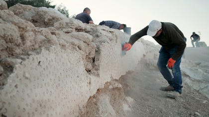
Sometime in the 20th century, archaeologists learned to date sites by changes in pottery styles; no reputable Israeli researcher would mistake a Roman cooking pot for a Byzantine vessel or an Umayyad creation. Plaster too changed over time, to a degree – it always needed lime, but in some eras it could be more pink, or more gray, Storchan explains. One Umayyad layer has small pebbles impressed into their plaster. That said, plaster isn’t a date book. Another challenge with securely dating the aqueduct is that while its entire course had once been covered with stone slabs, those slabs are gone.
Things that never change
But two things were unchanging throughout its lifetime: the force of gravity, and theft.
Along the aqueduct in general, archaeologists have identified spots where the local farmers poked holes into the pipeline to steal the water, and we know this because they found the repaired holes, a lot of them.
“This was an official governmental structure, whether Hasmonean or Byzantine or whatever,” Storchan points out.It wasn’t a private project, it was a national one and that involved not only clever engineers but armed guards on patrol for villagers ruining the branch into which they were poking holes.
So we knew of the aqueduct and its route; now a large stretch has been found and what have we learned from it?
“Mainly that looking at it today, in many sections it looks like a terrace. The rear wall is covered with dirt while the front wall is exposed, like a step,” Storchan says. “Excavating the back portion, we see that the sedimentology soil buildup was more gradual than thought – it hadn’t been backfilled. The original Hasmonean construction of may have stood as a freestanding element. Through natural processes over 2,000 years it was covered by soil flow. It didn’t seem to have bothered anyone that the backwall was becoming covered up,” he added.
Augmenting the Gihon Spring and unreliable rain as a water source for Jerusalem, the Lower and Upper Aqueducts enabled the city to expand in the Hasmonean period, and would continue to provide water for the next 2,000 years.
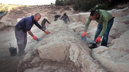
“What’s really cool about this is that we literally see a cross section of time in one element,” Storchan sums up. Jerusalem archaeology can be a terrific mess, with layers upon layers and some of them mixed up, Roman ruins lying over Byzantine mosaics, for instance – horrible. It’s partly due to destructions and partly due to repurposing. But in the aqueduct, you can see all the time periods in a single installation, one that brought water to the Temple Mount for ritual cleansing – plausibly at the very set of monumental mikvehs archaeologists revealed just last month.
Source: www.haaretz.com